Saint Lucia
| Saint Lucia | ||||||
|---|---|---|---|---|---|---|
| ||||||
| Motto: "The Land, The People, The Light" | ||||||
| Anthem: Sons and Daughters of Saint Lucia | ||||||
 | ||||||
| Capital (and largest city) | Castries 14°1′N 60°59′W / 14.017, -60.983 | |||||
| Official languages | English and Patois | |||||
| Demonym | Saint Lucian | |||||
| Government | Parliamentary democracy and Constitutional monarchy | |||||
| - | Queen | Elizabeth II | ||||
| - | Governor-General | Dame Pearlette Louisy | ||||
| - | Prime Minister | Stephenson King[1] | ||||
| Independence | ||||||
| - | from the United Kingdom | 22 February 1979 | ||||
| Area | ||||||
| - | Total | 620 km2 (193rd) 239 sq mi | ||||
| - | Water (%) | 1.6 | ||||
| Population | ||||||
| - | 2005 census | 160,765 | ||||
| - | Density | 298/km2 (41st) 672/sq mi | ||||
| GDP (PPP) | 2007 estimate | |||||
| - | Total | $1.772 billion[2] | ||||
| - | Per capita | $10,521[2] | ||||
| GDP (nominal) | 2007 estimate | |||||
| - | Total | $960 million[2] | ||||
| - | Per capita | $5,700[2] | ||||
| HDI (2007) | ▲ 0.795 (medium) (72nd) | |||||
| Currency | East Caribbean dollar (XCD) | |||||
| Time zone | (UTC-4) | |||||
| Drives on the | left | |||||
| Internet TLD | .lc | |||||
| Calling code | 1 758 | |||||


- Also see: Saint Lucia (disambiguation).
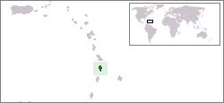
Saint Lucia (pronounced /ˌseɪnt ˈluːʃɪə/) is an island nation in the eastern Caribbean Sea on the boundary with the Atlantic Ocean.[3] Part of the Lesser Antilles, it is located north of the islands of Saint Vincent and the Grenadines, northwest of Barbados and south of Martinique. It is also known as the "Helen of the West Indies" because it switched between British and French control so often it was likened to the mythical Helen of Troy.
Saint Lucia is one of the Windward Islands, named for Saint Lucy of Syracuse. It was first visited by Europeans in about the year 1500 and first colonized successfully by France who signed a treaty with the native Carib peoples in 1660. Great Britain took control of the island from 1663 to 1667 then went to war with France over it fourteen times, and finally took complete control in 1814. Representative government came about in 1924 (with universal adult suffrage from 1953) and from 1958 to 1962 the island was a member of the Federation of the West Indies. Finally, on February 22, 1979, Saint Lucia became an independent state of the Commonwealth of Nations.[3] The island nation celebrates this every year with a public holiday.
Contents1 History
|
History
Politics
- See also: Foreign relations of Saint Lucia
As a Commonwealth realm, Saint Lucia recognizes Queen Elizabeth II as the Head of State of Saint Lucia, represented on the island by a Governor-General. Executive power, however, is in the hands of the prime minister and his cabinet.[3] The prime minister is normally the head of the party winning the elections for the House of Assembly, which has 17 seats.[1] The other chamber of Parliament, the Senate, has 11 appointed members.
Saint Lucia is a full and participating member of the Caribbean Community (CARICOM) and the Organisation of Eastern Caribbean States (OECS).
Districts and quarters
Saint Lucia is divided into 17 electoral districts for the Parliament,[1] as the 17 seats in the House of Assembly (each with title "Parliamentary Representative").[1] The 17 electoral districts are:
|
|
 |
Saint Lucia has 11 quarters, or sections of the island, which were sometimes called "districts" under the British colonial government.
Saint Lucia is divided into 11 quarters:
- Anse la Raye Quarter
- Canaries Quarter
- Castries Quarter
- Choiseul Quarter
- Dauphin Quarter
- Dennery Quarter
- Gros Islet Quarter
- Laborie Quarter
- Micoud Quarter
- Soufrière Quarter
- Vieux Fort Quarter
Note that the quarters are not the electoral districts, as Canaries & Anse La Ray form one electoral district, not two.
Geography


The volcanic island of Saint Lucia is more mountainous than many other Caribbean islands, with the highest point being Mount Gimie, at 950 metres (3,120 ft) above sea level. Two other mountains, the Pitons, form the island's most famous landmark. They are located between Soufrière and Choiseul on the western side of the island. Saint Lucia is also one of the few islands in the world that boasts a drive-in volcano.
The capital city of Saint Lucia is Castries, where about one third of the population lives. Major towns include Gros Islet, Soufrière and Vieux Fort. The local climate is tropical, moderated by northeast trade winds, with a dry season from January to April and a rainy season from May to December.
Economy
The recent change in the European Union import preference regime and the increased competition from Latin American bananas have made economic diversification increasingly important in Saint Lucia. The island nation has been able to attract foreign business and investment, especially in its offshore banking and tourism industries, which is the island's main source of revenue. The manufacturing sector is the most diverse in the Eastern Caribbean area, and the government is trying to revitalize the banana industry. Despite negative growth in 2001, economic fundamentals remain solid, and GDP growth should recover in the future.
Demographics
The population of Saint Lucia is of mostly African descent (82.5% of the population). There is also a significant Mixed minority representing 11.9%, with Indo-Caribbean or Indian groups at 2.4% and the small European origin minority (descendants of French, British, and Irish colonists). Other or unspecified ethnicity accounts for 3.1%. There are small numbers of Lebanese, Syrians and Chinese.
The official language is English, but a creole language called Patois is spoken by 80% of the population and is getting increasing usage and official recognition.[4] It evolved from French, African languages, and Carib. Saint Lucia is a member of La Francophonie.
St. Lucia boasts the highest ratio in the world for number of Nobel laureates produced with respect to the total population of the nation. Two winners have come from St. Lucia: Sir Arthur Lewis won the Nobel Prize in Economics in 1979, and Derek Walcott received the Nobel Prize in Literature in 1992. Both were born on January 23rd, but in different years.
About 70% of the population is Roman Catholic. The rest are Seventh-day Adventists (7%), Pentecostalists (6%), Anglicans (2%), Evangelicals (2%) and Rastafari (2%).[5]
Migration from Saint Lucia is primarily to Anglophone countries, with the United Kingdom (see Saint Lucian British) having almost 10,000 Saint Lucian born citizens, and over 30,000 of Saint Lucian heritage. The second most popular destination for Saint Lucian expatriates is the United States, where combined (foreign and national born Saint Lucians) almost 14,000 reside. Canada is home to a few thousand Saint Lucians, whilst most other countries in the world have less than 50 citizens of Saint Lucian origin (the exceptions being Spain and France with 124 and 117 Saint Lucian expats respectively).[6]
Culture
- See also: Derek Walcott and Music of Saint Lucia

The culture of Saint Lucia has been influenced by African, French and English heritage. One of the secondary languages is Creole, a form of French patois.
- Festivals
Saint Lucian cultural festivals include La Rose and La Marguerite, the one representing the Rosicrucian order, the other one representing Freemasonry, which can be seen on a mural painted by Dunstan St. Omer, depicting the holy trinity of Osiris, Horus and Isis.
Traditionally, in common with other Caribbean countries, Saint Lucia held a carnival before Lent. In 1999, it was moved to mid-July in order to not to coincide with the much larger Trinidad and Tobago carnival, so as to attract more overseas visitors.
- Music and dance
A popular folk dance is the Quadrille.
As well as other Caribbean music genres such as soca, zouk, kompa, and reggae, Saint Lucia has a strong indigenous folk music tradition.
Each May since 1992, Saint Lucia has hosted an internationally-renowned Jazz Festival.
Tourism
Tourism is vital to St. Lucia's economy and the economic importance of such is expected to continue to increase as the market for bananas becomes more competitive. Tourism tends to be more substantial during the dry season (January to April). St Lucia tends to be popular due to its tropical weather and scenery and its large number of beaches and resorts.
Other tourist attractions include the world's only drive-in volcano, Sulfur Springs (at Soufriere), the Botanical Gardens, the rain forests and Pigeon Island National Park, which is home to Fort Rodney, an old British military base.
The majority of tourists visit St. Lucia as part of a cruise. Most of their time tends to be spent in Castries, although Soufriere, Marigot Bay and Gros Islet are popular locations to visit. Tourists should venture from the beaten path of shops and beaches and explore the beautiful nature of St. Lucia. Marigot Bay is where a second home to the boxer George Foreman is situated.

Gallery
 Gros Piton seen from the Ladera Hotel restaurant – September 2007 |  Petit Piton seen from the Ladera Hotel restaurant – December 2004 |  View from Pigeon Point (Fort Rodney) – 2006 |  Soufrière Bay – February 2006 |
 Hilltop view of resort – June 2006 |  Typical sight in Canaries: houses on hills, June 2006 |  St Lucia beach – February 2006 |
 View of Marigot Bay - December 2007 |  View from the Le Sport resort – March 2006 |  Boy lying on sand pile, June 2006 |
No comments:
Post a Comment